Ever paused to ponder how humanity keeps tabs on Earth’s most formidable and fiery giants? For millennia, predicting the moods of volcanoes has been a perilous gamble, relying heavily on brave, often at-risk, human researchers. But what if there was a way to peer into the very heart of danger without putting a single soul in harm’s way?
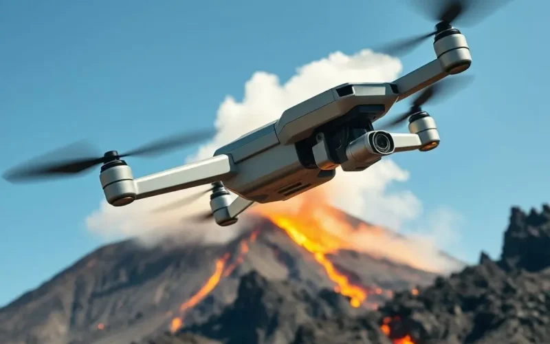
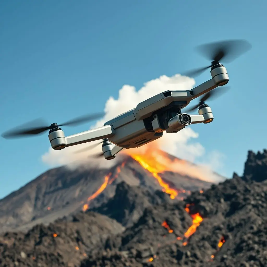
Enter the realm of volcano drones. These aren’t merely sophisticated toys; they are, in essence, high-tech sentinels, meticulously designed to patrol our planet’s most volatile hotspots. Imagine agile machines, unburdened by human limitations, soaring directly into gas plumes and ash clouds, gathering critical data that was once utterly inaccessible. This is the monumental leap vulcanology has been waiting for, a true game-changer in our quest to understand and forecast volcanic activity.
Before we dive deeper into the incredible capabilities of these aerial guardians, take a moment to watch this short, captivating video that perfectly captures the essence of what we’re talking about:
Table of Contents
The Perilous Pursuit: Why Traditional Monitoring Fell Short
For decades, volcano monitoring largely hinged on a combination of seismic sensors, ground-based GPS stations, satellite imagery, and the intrepid work of geologists. While effective to a degree, these methods often presented significant limitations:
- Accessibility: The most critical data points often lie within unstable summit craters, fumaroles emitting toxic gases, or areas prone to sudden eruptions and landslides – places too dangerous for prolonged human presence.
- Real-Time Data Gaps: Satellite data, while broad, lacks the granular detail and immediacy needed for precise, real-time localized changes. Ground sensors, while accurate, are static and can be destroyed by eruptive events.
- Human Risk: Scientists performing fieldwork are constantly exposed to risks from gas inhalation, sudden explosions, rockfalls, and lava flows. This dramatically limits the frequency and duration of direct observations.
- Environmental Challenges: Harsh weather conditions, extreme temperatures, and corrosive gases can degrade or destroy traditional monitoring equipment, leading to data loss.
These challenges underscored a critical need for a new approach – one that could collect comprehensive, real-time data from hazardous zones without risking human lives.
The Sky-High Guardians: Introducing Volcano Drones
The advent of unmanned aerial vehicles (UAVs), specifically adapted for extreme environments, has ushered in a new era for vulcanology. These aren’t your typical hobby drones; they are highly specialized platforms engineered for resilience and equipped with an array of sophisticated sensors.
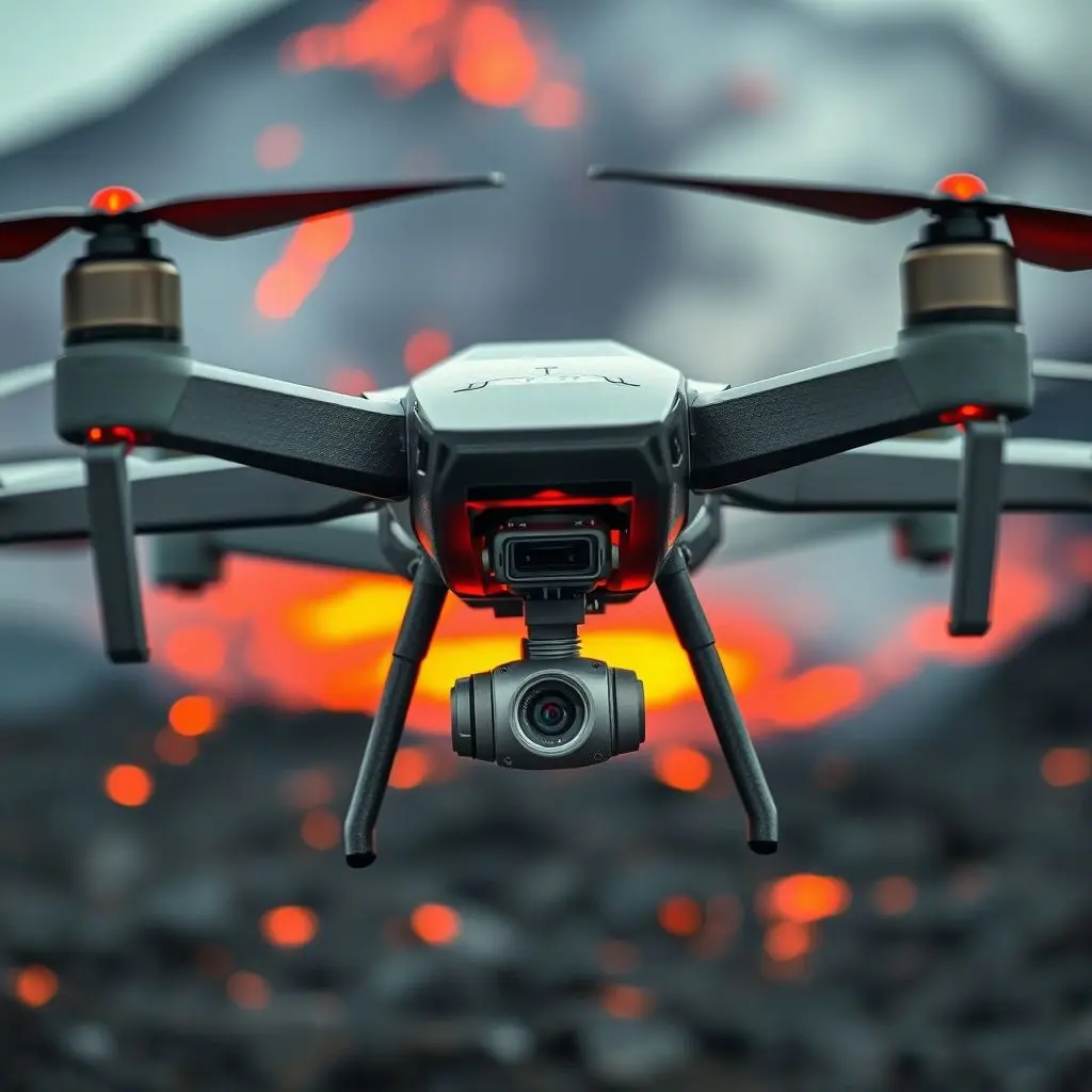
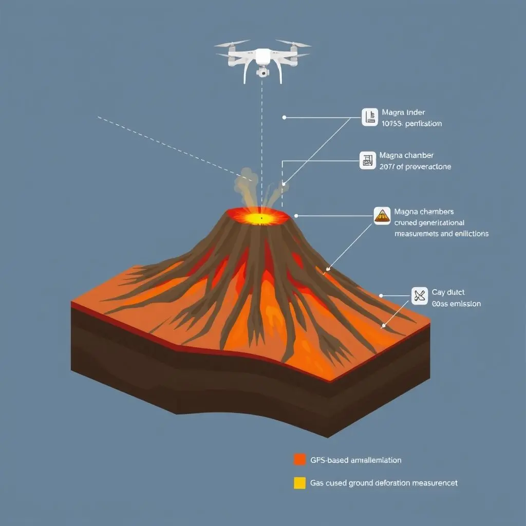
Anatomy of a Volcano Drone: Sensors and Sophistication
The true power of volcano drones lies in their payload – the suite of cutting-edge sensors they carry. Each sensor plays a vital role in painting a complete picture of a volcano’s activity:
- Thermal Sensors (Infrared Cameras): These are paramount for detecting changes in surface temperature. Rising magma heats the ground, alters fumarole temperatures, and can create new hotspots. Thermal cameras provide detailed heat maps, revealing subtle shifts invisible to the naked eye. This data can indicate magma migration closer to the surface or increased hydrothermal activity.
- Gas Sensors: Volcanic gases (like SO2, CO2, H2S, HCl) are crucial indicators of a volcano’s internal state. Changes in gas composition ratios, emission rates, or the appearance of new gas vents can signal impending eruptions. Drones equipped with miniature gas spectrometers and chemical sniffers can fly directly into gas plumes, collecting samples and analyzing concentrations in real-time, providing data that’s impossible to get from the ground.
- Multispectral and Hyperspectral Imagers: These cameras capture data across many different light wavelengths, beyond what human eyes can see. This allows scientists to identify specific minerals, detect changes in vegetation (stress from gas emissions), or even differentiate between types of volcanic ash, providing insights into geological processes and past eruption dynamics.
- LiDAR (Light Detection and Ranging): LiDAR systems use pulsed laser light to measure ranges, creating highly accurate 3D maps of the terrain. For volcanoes, LiDAR can detect subtle ground deformation – bulges, cracks, or subsidence – that indicate magma movement beneath the surface. Repeated LiDAR scans over time allow for precise measurement of even millimeter-scale changes, which are vital precursors to eruptions.
- High-Resolution Cameras and GPS: Standard optical cameras capture detailed visual information, while precise GPS (Global Positioning System) modules log the drone’s exact location, allowing for georeferencing of all collected data, ensuring accuracy in mapping and analysis.
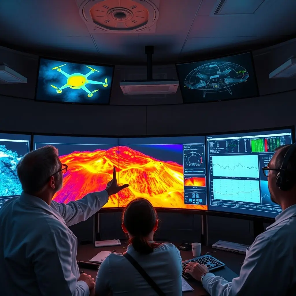
Data That Speaks Volumes: Real-time Insights
The data collected by volcano drones isn’t just vast; it’s transformative. It provides vulcanologists with:
- Unprecedented Spatial Resolution: Drones can map an entire crater or specific fissure with incredible detail, identifying localized anomalies that broader satellite or ground-based sensors might miss.
- Temporal Flexibility: Drones can be deployed rapidly and repeatedly, offering frequent snapshots of volcanic activity, unlike the logistical complexities of human expeditions. This temporal resolution is key to tracking evolving conditions.
- Direct Observation: Flying directly over vents and into plumes provides direct measurements of gas concentrations and temperatures, offering more accurate and immediate insights into the volcano’s internal plumbing system.
Sharpening the Crystal Ball: Drones and Eruption Forecasting
The real power of volcano drones culminates in their ability to dramatically enhance eruption forecasting, shifting it from an educated guess to a more informed prediction.
Unprecedented Access, Unrivalled Safety
By providing access to the most perilous parts of a volcano, drones fill critical data gaps. Scientists can now obtain comprehensive, real-time information on ground deformation, thermal anomalies, and gas emissions from within the crater itself – data that directly correlates with magma movement and pressure changes deep within the volcano. This drastically improves the accuracy and timeliness of eruption warnings, allowing for more effective evacuation plans and mitigating potential disasters.
Beyond Prediction: Broader Applications
While eruption forecasting is paramount, volcano drones serve a multitude of other vital functions:
- Post-Eruption Assessment: After an eruption, drones can safely map fresh lava flows, assess damage, identify new hazards, and monitor cooling rates, providing crucial information for recovery efforts without endangering human responders.
- Long-term Monitoring: For continuously active or dormant but potentially dangerous volcanoes, drones can establish a baseline of activity and monitor subtle changes over months or years, contributing to long-term hazard assessments.
- Research and Education: The high-resolution data and imagery collected by drones offer invaluable resources for scientific research, allowing for new discoveries about volcanic processes and providing compelling educational material.
Navigating the Storm: Challenges and the Path Ahead
Despite their revolutionary potential, volcano drones face their own set of challenges:
- Battery Life & Endurance: Extreme heat, strong winds, and corrosive gases can severely limit drone flight times and the lifespan of internal components. Developing more robust batteries and propulsion systems is an ongoing challenge.
- Data Management: The sheer volume and complexity of data generated by multiple sensors require sophisticated processing, analysis, and storage infrastructure.
- Regulatory Hurdles: Operating UAVs in restricted airspace, especially near active volcanoes, involves complex permits and regulations, which can vary significantly by country.
- Cost: High-end, custom-built volcano drones and their sophisticated sensor payloads are expensive, limiting widespread adoption, particularly in developing nations.
However, the future is incredibly promising. Advancements in AI and machine learning are enabling drones to interpret data more autonomously, identify anomalies in real-time, and even adapt their flight paths based on environmental conditions. Swarm technology, where multiple drones collaborate, could provide even more comprehensive coverage. Miniaturization of sensors and improvements in materials science will further enhance their capabilities and resilience.
Frequently Asked Questions (FAQs)
Here are some common questions about volcano drones:
Q: Are volcano drones entirely autonomous?
A: Many volcano drones are semi-autonomous, meaning they can follow pre-programmed flight paths and maintain stability in challenging conditions, but human operators typically oversee their missions, monitor data, and intervene if necessary. Fully autonomous missions are a growing area of research.
Q: What types of volcanoes are best suited for drone monitoring?
A: Drones are highly versatile and can be used to monitor various types of volcanoes, especially those with inaccessible craters, persistent gas plumes, or areas prone to frequent, small eruptions. They are particularly valuable for volcanoes in remote locations or those with high-risk summits.
Q: Can drones predict the exact time of an eruption?
A: While drones drastically improve eruption forecasting by providing unprecedented data, predicting the *exact* time of an eruption remains a complex scientific challenge. Volcanoes are inherently unpredictable. Drones provide critical information that refines the likelihood and potential scale of an eruption, allowing for better preparedness and timely warnings, but not typically precise timing.
Q: How long can a volcano drone typically stay airborne in a hazardous environment?
A: Flight times vary greatly depending on the drone model, payload, and the severity of the volcanic environment. In extreme conditions (high heat, dense gas plumes), flight times might be limited to 15-30 minutes to protect sensitive electronics and batteries. In less hostile conditions, some specialized drones can fly for an hour or more.
Flying High Towards a Safer Future
The integration of drone technology into vulcanology is nothing short of a revolution. By pushing the boundaries of what’s possible, these unmanned explorers are not just collecting data; they are reshaping our relationship with Earth’s most powerful geological forces. They embody a future where cutting-edge innovation directly translates into enhanced safety and a deeper understanding of our dynamic planet. Truly, when danger looms, innovation flies high, safeguarding lives and unlocking secrets from the fiery depths below.
Related posts:
 AI in Action: Revolutionizing Disaster Response with Drones, Prediction, and Logistics
 Flying Green: How Seed Bombing Drones Are Taking Reforestation Sky-High
 Tech That “Listens” to Plants: Optimizing Farming Through Data
 AI Lie Detection: Can Code Really Unmask Deception Better Than a Polygraph?
 AI in Drug Discovery: Revolutionizing How We Find New Medicines